kartaber.gif (16715 bytes)


Berg Locks and Bridge
< Westwards | Malfors Bridge | Berg Locks and Bridge | Eastwards >

vala023162_kungsbro_250.jpg (9821 bytes)Berg Locks are an excellent example of the modern canal-construction technology (see also Canal History/Engineering on the main menu).

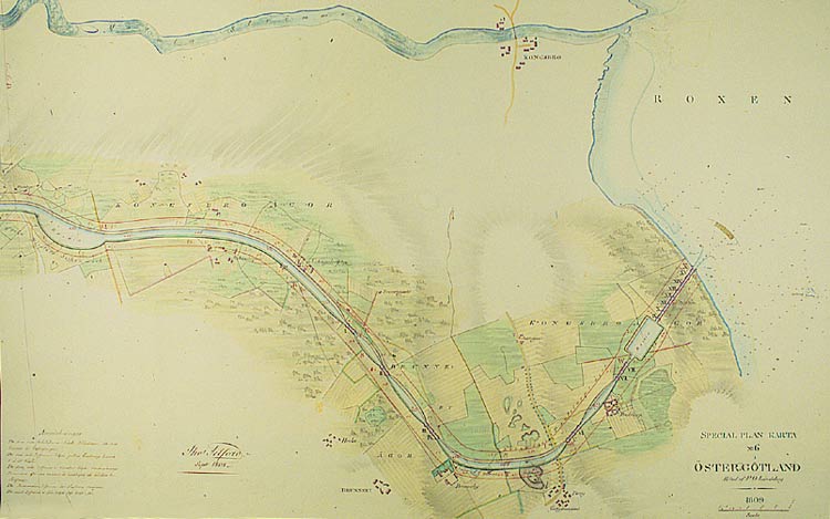
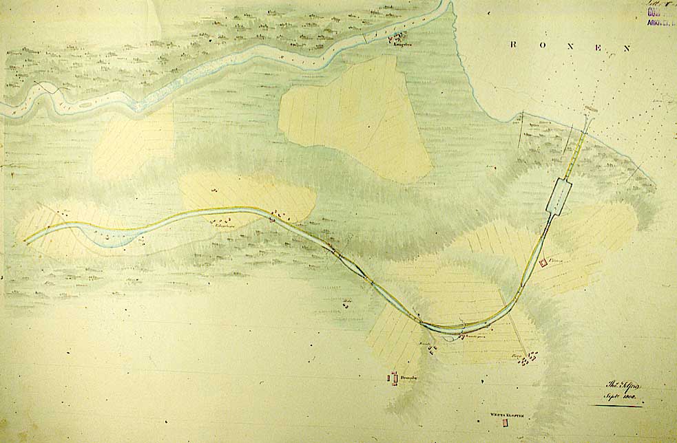
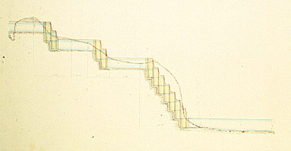
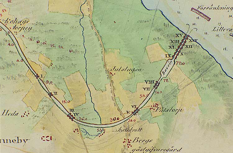
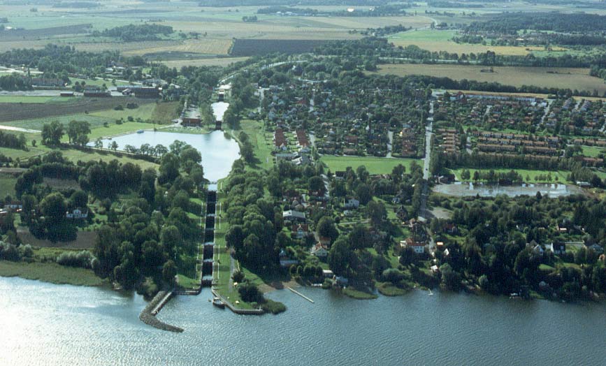
The equalising locks have been grouped together at the edge of the western shore of Lake Roxen in order to create a long, uninterrupted stretch of canal all the way from Heda to Borenberg. Constructing the locks in such a manner had advantages when it came to aspects as transportation economics and building technology.

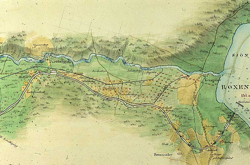
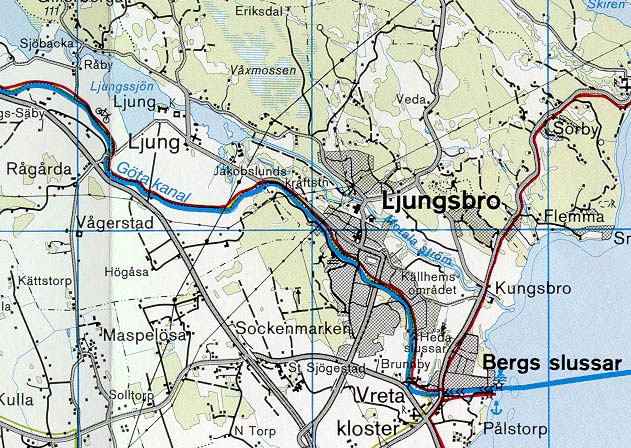
As a result canal traffic sped up, since there wasn't the frequent interruption of lockage. This construction also allowed the selecting of the places with the best foundation conditions.

In the chronological sequence of maps (below), one can take a closer look at the following: how the location of the canal and its outlet into Lake Roxen were modified; how the docks were changed; where the settlement of that time was situated; and how the farms were affected by the building of the canal.

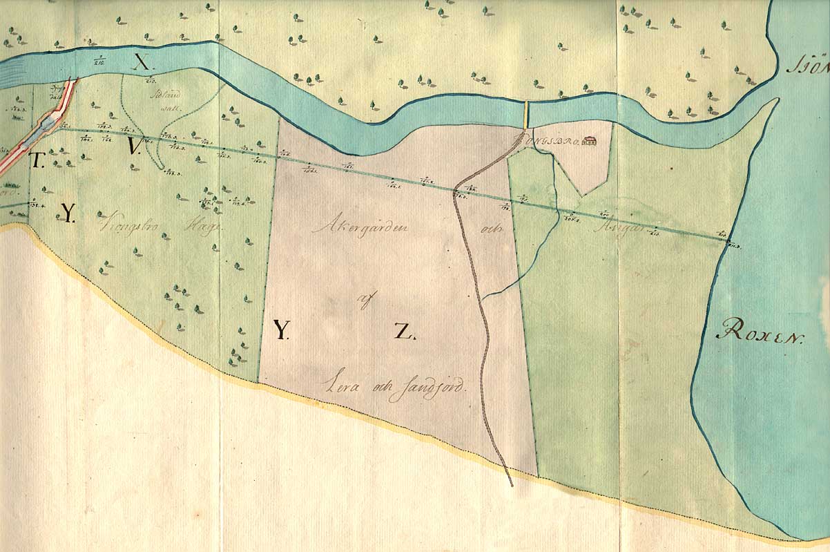
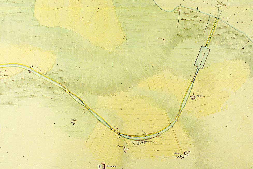
On the map from 1774 (above), the proposed outlet of the canal was the river Motala Ström. The cartographer has written "Djup däld," i.e. deep, long valley, on the map. By this he probably meant that natural conditions existed here for building a lock to the side of the rapids of the river Motala Ström.

One can also easily read the various types of soil. The straight line that goes from the proposed canal down to the shore of Lake Roxen is a levelling line, in which the surveyor has measured and noted the differences in altitude. (VaLa von Röök, 1774)

Click on the maps and the images to enlargen!  Use the "Back" button to return.


Other maps of the area:
thbg_I17_ljung-roxen.jpg (90334 bytes) This map (left) is from 1784, i.e. it was completed ten years after the above map. It is a good illustration of the breakthrough of the modern canal-excavation technology. (See also Canal History on the main menu).

Some interesting details should be noticed. (Top left) Canal proposal from 1774. A new outlet, closer to Kungsbro, with a lock stairway consisting of 12 locks and a dock, have been drawn on the map. A man-made lake, at the same level as Ljungsbro, can also be seen on the map. In the lower right corner, sketched in pencil, is the third proposal for the canal's outlet into Lake Roxen. These are perhaps the first-known sketches of the lock stairway and the docks at Berg.
(Thunberg, 1784).

berg_316_gkm_socber_telf_91809_max.jpg (53855 bytes) Proposal for the stretch of canal at Berg, signed by Thomas Telford, 1808 The stretch of canal and the surrounding canal banks are marked in red.
berg_39_gkm_borroxover_telf_91808.jpg (67426 bytes) General map of the stretch of canal from Berg to present-day Ljungsbro, including the dock area by the Malfors Bridge. One can also see the farms that would be moved as soon as canal digging began. (Telford, 1809).

Further reading: Canal Research at Linköping University- Gunhild Wingårdh, Losses of land and Recompensations (In Sw.: Markförluster och markersättningar) 1993.

berg_327_gkm_kohberdet_telf_91808.jpg (69016 bytes) Detailed part of the above map.
bergprofil1808.jpg (17505 bytes) Profile of the shoreline and the planned locks at Berg, Brunnby and Heda.
berg_320_gkm_borroxover_fors_1809_max.jpg (96358 bytes) All three canal proposals can be seen on this general map. The canal watercourse primarily follows contour line from Heda to Ljung. It is this stretch of canal that will be realised. Note the line in pencil in the bend at Heda and Brunn(e)by. This indicates an alternative stretch of canal and positioning of the lock stairway at Berg.
[Carl G. Forssell, 1809)
berg_324_gkm_berroxdet_fors_1809_max.jpg (60528 bytes) Detailed part of the above map, showing the bend at Heda and the alternative stretch of the canal. Notice the rectangular form of the dock. (1809)
(1809)
berg_33_gkm_brubergdet_1823_max.jpg (55159 bytes) Map of the nearly finished locks at Berg and Brunnby and the dock area. The map also shows the property lines at that time. (1823)
berg_fr_rox_bred_flyg.jpg (86679 bytes) Aerial photo of lock stairway and surrounding settlement.

Source: County Administrative Board in Östergötland, Cultural Environment Office.

Photo: Jan Norrman, the Swedish Central Board of Antiquities, 1991.

skarpasen-roxen_turistkarta.jpg (114087 bytes) General map of the stretch of canal between Skarpåsen (Ljungsbro) and Berg.

(AB Göta kanal Tourist Map: Eastern Section, 1995).

Blue line = Gothenburg - Stockholm route of the Göta Canal used by the firm of shipowners Rederi AB Göta kanal.

Red line = bicycle path.