kartaber.gif (16715 bytes)


Malfors Bridge
< Westwards | Malfors Bridge | Berg Locks and Bridge | Eastwards >

vala023162_malfors_250.jpg (11640 bytes)Malfors Bridge was originally the name of the bridge over the river Motala Älfven, as noted on this map (left), from 1774. Von Röök thought of building a lock in the canal by the Malfors Rapids.

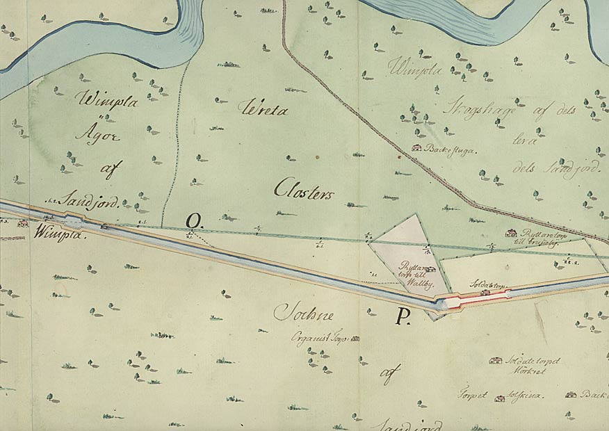
The map shows in detail the use of the land at that time and the various types of houses, such as the Wimpla Farm (named after the organist in the church Vreta Kloster), the horseman's croft, the soldier's croft, etc. Examples of the latter include the soldier's crofts with the contrasting names of Solskina (Sunshine) and Mörkret (Darkness) (Vala).

  
Click on the maps to enlargen!
Use the "Back" button to return.


Other maps of the area:
telf_III16_1808_malfors.jpg (63863 bytes) This map from 1808 shows the planned stretch of canal by the present-day Ljungsbro. One can clearly see a dock, a widening of the canal, which later came to be a loading dock.

Someone has written "To Malfors" in pencil, and thereby probably given birth to the current name of the place, i.e. the bridge over the canal that leads to Malfors Bridge.
telf_III16_1808_malfors-koh.jpg (95037 bytes) This is a section of the above map, which shows the stretch of canal.
The croft Kohagstorpen, marked on the map, is today the location of the aqueduct at Ljungsbro. Further eastwards on the map, one can see an unnamed farm that was forced to make room for the building of the canal. Today, the area Källhemsområdet, in Ljungsbro, lies north of the canal. (Further reading: Canal Research at Linköping University - Gunhild Wingårdh, Land losses and Recompensations. In Sw.: Markförluster och markersättningar, Linköping 1993.)
skarpasen-roxen_turistkarta.jpg (114087 bytes) General map of the stretch of canal between Skarpåsen (Ljungsbro) and Berg.
(AB Göta kanal Tourist Map: Eastern Section, 1995).
Blue line = Gothenburg - Stockholm route of the Göta Canal used by the firm of shipowners Rederi AB Göta kanal.
Red line = bicycle path.