|
Sj—torp Locks Sj—torp Locks | Rogstorp Bridge | Lyrestad Bridges | Norrkvarn Locks and Bridges | Eastwards > |
Click on the maps to enlargen! |
|
Sj—torp Locks Sj—torp Locks | Rogstorp Bridge | Lyrestad Bridges | Norrkvarn Locks and Bridges | Eastwards > |
Click on the maps to enlargen! |
Other maps of the area: |
||
 |
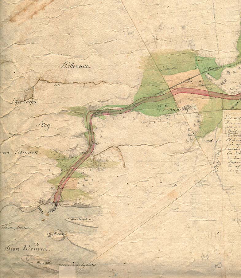
Detail of Daniel Thunberg's general map from 1784, which shows how the canal was widened to allow for vessels to navigate through the sharp bend at Sm—rgÍsekr—ken. | |
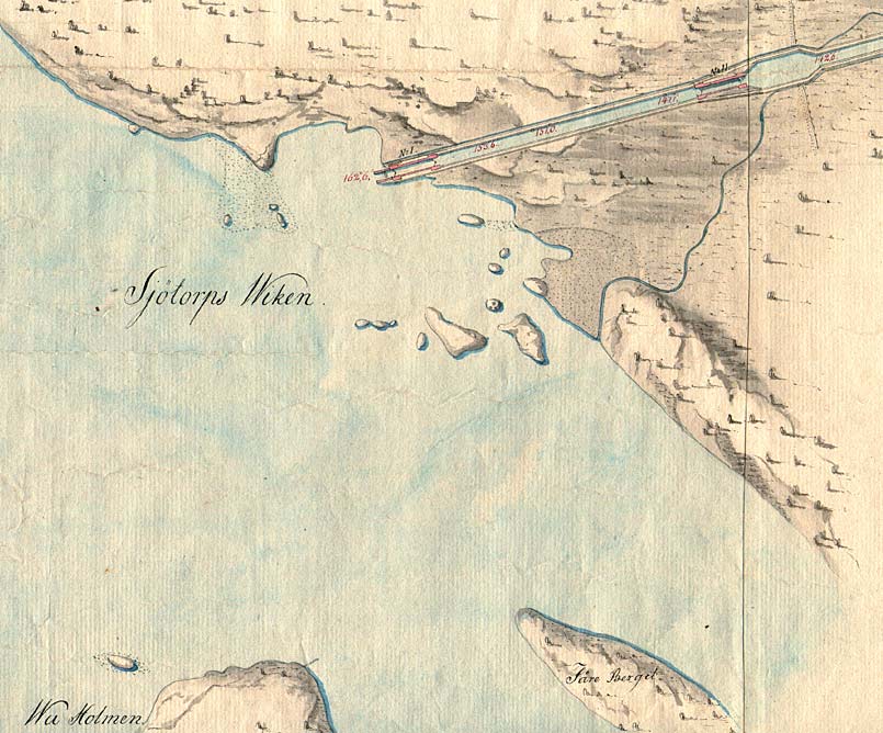 |
This map is a detail of the above map. It shows the entrance of the G—ta Canal in Sj—torp Bay, in Lake Vðnern. | |
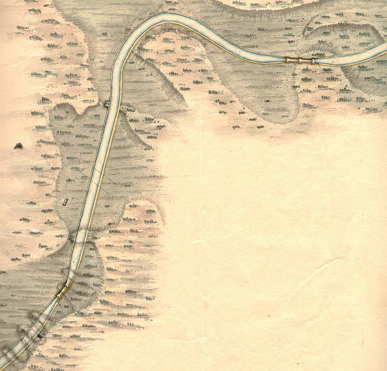 |
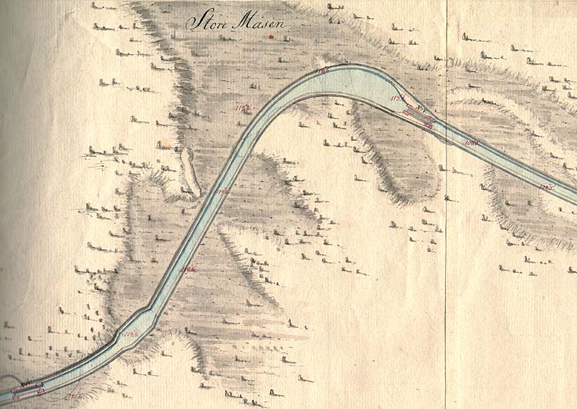
Telford's map from 1808 that depicts Sm—rgÍgsekr—ken and locks number six to eight of the Sj—torp Locks. | |
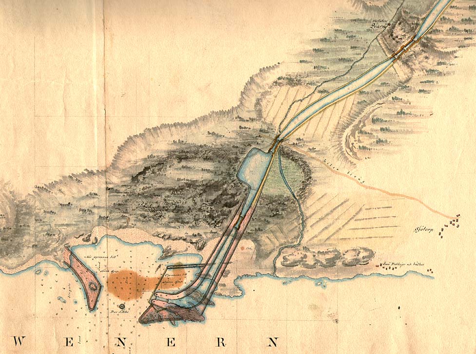 |
The canal entrance in Lake Vðnern, according to the above map by Telford. It was thought that the entrance could be the location of a harbour, with storm-sheltering piers, made of stone, and a centrally located dolphins for approaching vessels. Farther up on the canal was planned to be the location of a harbour dock and a shipyard dock. | |
| Sj—torp Shipyard with dock, buildings and dry dock. The workshop right in front of the shipyard nowadays houses the Canal Museum.
(Photo R Castensson, 1999). |
||
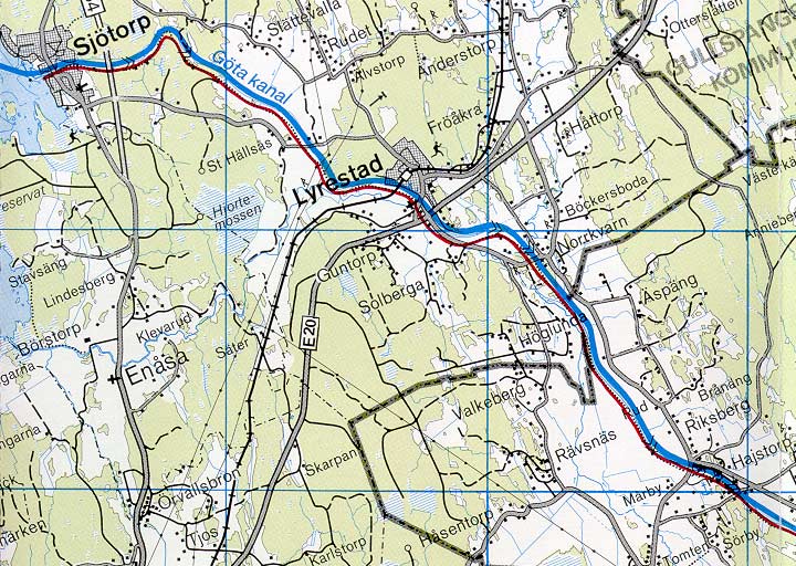 |
General map of the stretch of the canal between Norrkvarn and Sj—torp.
(AB G—ta kanal Tourist Map: Western Section, 1995). Blue line = Gothenburg - Stockholm route of the G—ta Canal used by the firm of shipowners Rederi AB G—ta kanal. Red line = bicycle path. |
|