kartaasp.gif (16784 bytes)


Hulta Lock
< Westwards | Hulta Lock | Snövelstorp Bridge | Klämman Lock
Loddby Bridge | Vänneberga Bridge |  Eastwards >

vala023146_hulta_250.jpg (20551 bytes)Hulta Lock is a single lock, completed in 1827.

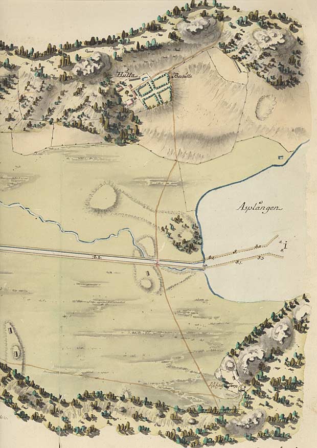
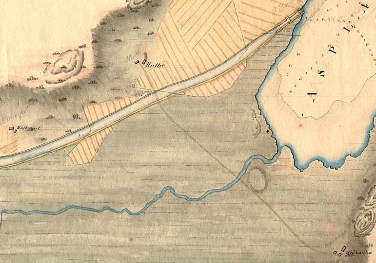
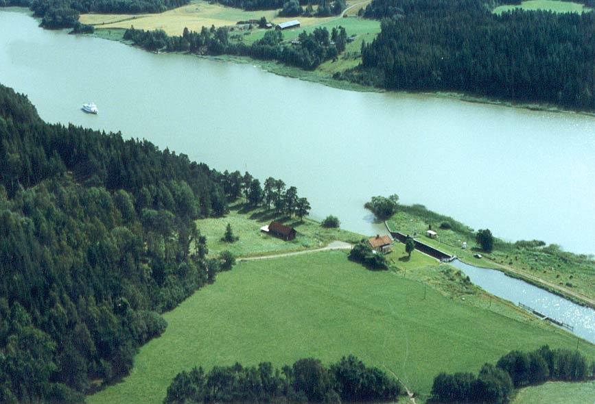
The lock received its name from the Hulta Manor, which is located in the upper half of von Röök's map from 1774. Hulta was the place of residence for chief canal mechanic Gustaf Lagerheim (1820 - 1845).

Down and to the right is the Sjöbacka Farm.

The canal proposal by von Röök also shows the depth measurements in Lake Asplången.

Click on the maps to enlargen!
Use the "Back" button to return.


Other maps of the area:
telf_III18_1808_hulta.jpg (76763 bytes) Telford, 1808
hulta_flyg.jpg (74892 bytes) Aerial photo of Hulta Lock

Source: County Administrative Board in Östergötland, Cultural Environment Office
Photo: Jan Norrman, the Swedish Central Board of Antiquities, 1991

turist_hulta-vanneberga.jpg (111668 bytes) General map of the stretch of canal between Hulta and Vänneberga.

(AB Göta kanal Tourist Map: Eastern Section, 1995)

Blue line = Gothenburg - Stockholm route of the Göta Canal used by the firm of shipowners Rederi AB Göta kanal.

Red line = bicycle path.