|
Klõmman Lock < Westwards | Hulta Lock | Sn÷velstorp Bridge | Klõmman Lock Loddby Bridge | Võnneberga Bridge | Eastwards > |
Here one can find a reconstruction of the original type of sluice gate without mechanical opening mechanisms. Instead there was a slightly bent balancing handle on the top of each sluice gate. By 1848 all sluice gates along the canal had mechanical opening mechanisms.
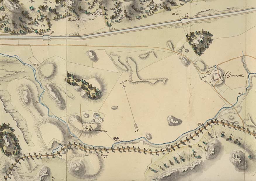
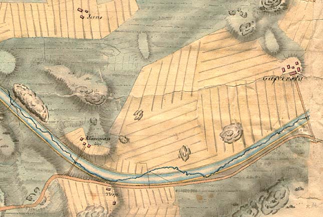
The Klõmman Farm and the Gõfwersta Manor can be found in von R÷÷k's canal proposal from 1774, in the southern part of the map. The proposed stretch of canal goes to the north here. In Telford's canal proposal from 1808 (below), the canal goes south of both the farm and the manor. Click on the maps to enlargen! Use the "Back" button to return.
|