kartatat.gif (16536 bytes)


Tåtorp Lock and Bridge
< Westwards | Jonsboda Bridge | Stång Bridge | Vassbacken Bridge | Lanthöjden | Tåtorp | Eastwards >

tatorp-lanthojden250.jpg (12550 bytes)Tåtorp Lock is an equalising/levelling lock used to balance the differences in water level between Lake Viken and the Göta Canal. The sluice gates are to this opened with a capstan.

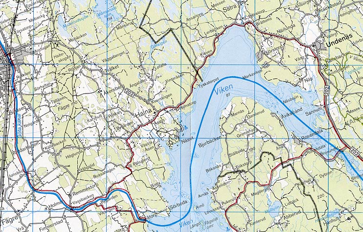
Lake Viken is the highest point on the Göta Canal (91.7 metres above sea level). Along with Lake Unden, Lake Viken is the water store house for the locks on the western section of the Göta Canal. The lakes are joined together at the river Edsån.

During the 1700s, one of the main issues discussed was the sufficiency of the water supply for the western section of the canal. At that time one did not have detailed measurements of the water level at hand. Instead, one had to rely on the observations of others in the area.
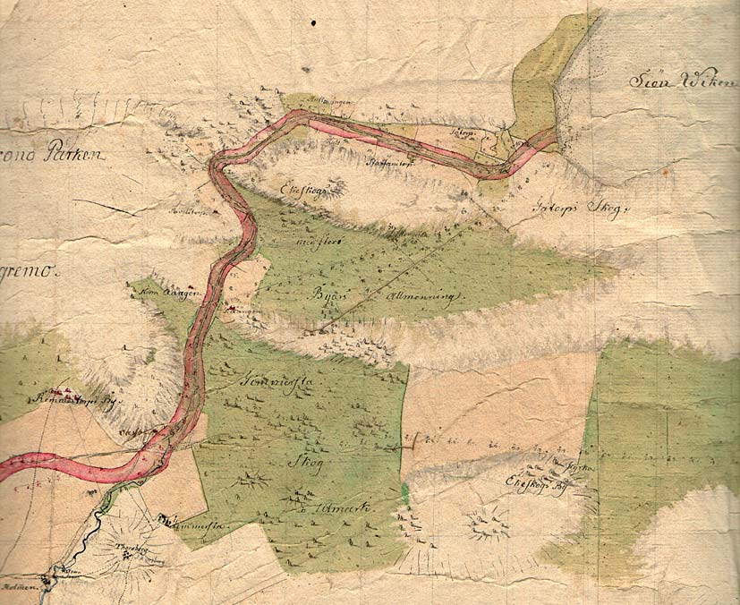
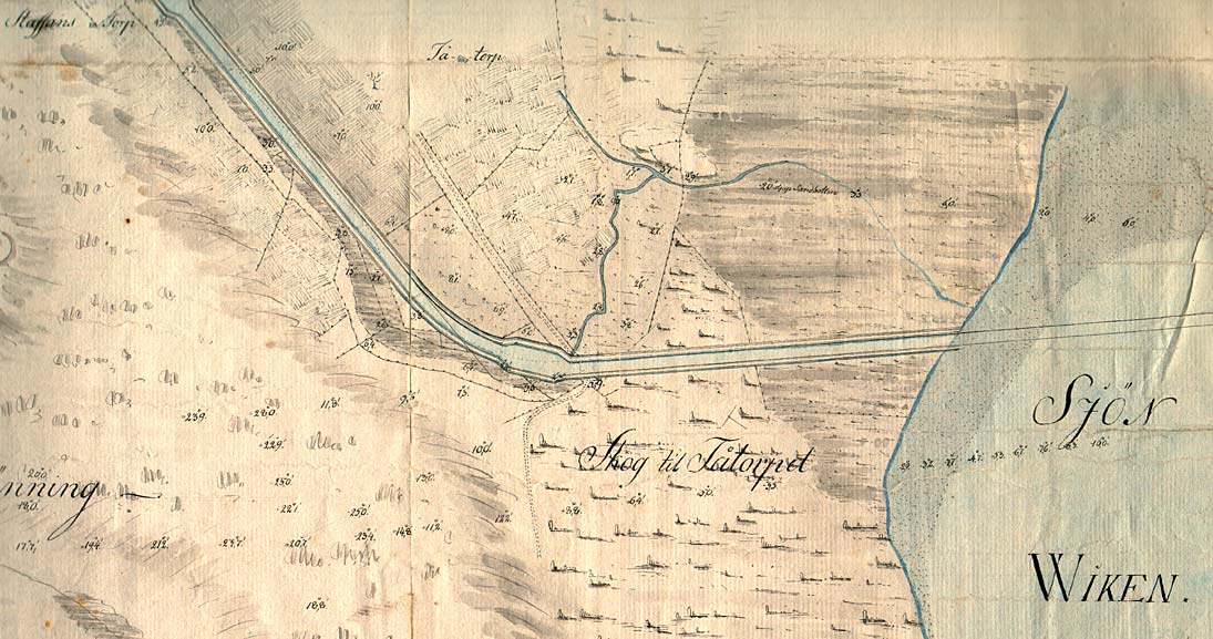
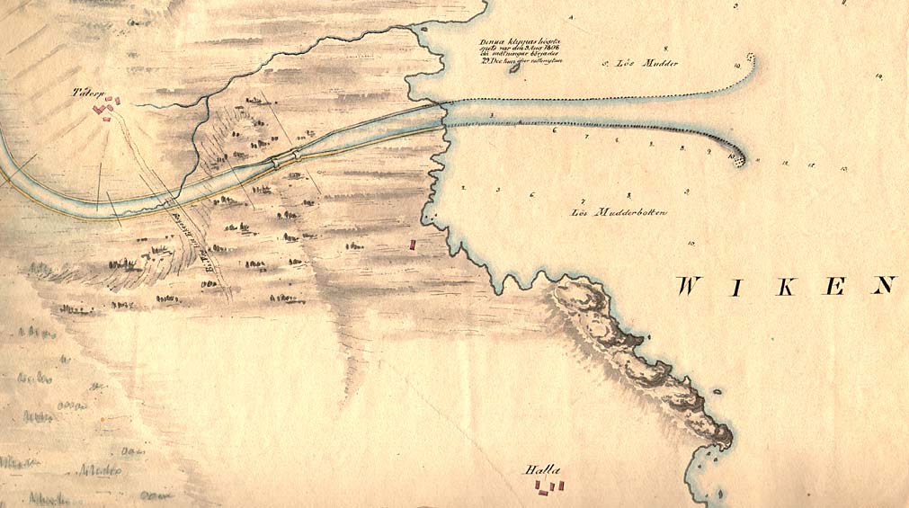
Tåtorp Lock was ready for use in 1814. In the beginning, there was no bridge in Tåtorp. In order to cross this part of the canal, inhabitants used a "Lina," a tiny ferry. Tåtorp Bridge was not built until 1953. The bridge is from a Dutch model.

General map from 1784, drawn by Elias Schveder, the artist in the construction of the Trollhätte Canal, located in western Sweden. The map shows the planned stretch of the Göta Canal as well as the spreading of the dirt from digging of the canal (marked in red).


Click on the maps to enlargen! Use the "Back" button to return.


Other maps of the area:
thbg_I12_tatorp.jpg (137158 bytes) Detail map from 1784, by engineer and castle master builder Daniel Thunberg.
telf_III8_1808_tatorp.jpg (88946 bytes) On this map from 1808 (left), there is a special emphasis placed on Lake Viken and its importance as the highest point on the Göta Canal. Furthermore, one can see the rocks in the water near the entrance of the canal. It was on these rocks that the British canal engineer Thomas Telford and his assistants carried out their control measurements. "The highest point on this place upon which we stand, on this date, 9 August 1808, when we began our measurements, was 29 decimal inches above the water level."

On this map, one can even see the equalising/levelling lock and the roads at that time. The villages of Tåtorp and Halla are also marked on the map.

Specifically noted on the map are the chracteristics of the lake bottom and the depth of the water.

turist_jonsboda-tatorp.jpg (155236 bytes) At the north end of Lake Viken, located near Sätra, one can find the above-named river Edsån and the mouth of the river.

General map of the stretch of canal between Jonsboda and Tåtorp

(AB Göta kanal Tourist Map: Western Section, 1995)

Blue line = Gothenburg - Stockholm route of the Göta Canal used by the firm of shipowners Rederi AB Göta kanal.

Red line = bicycle path.