kartamem.gif (16633 bytes)


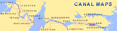
Tegelbruket Lock
< Westwards  | Carlsborg Locks | Mariehov Locks | Duvkullen Locks | Klevbrinken
Söderköping Lock  | Tegelbruket Lock | Vargklyftan | Mem

vala023155_tegelbruket_250.jpg (8841 bytes)

Tegelbruket, east of Söderköping, and the salt storehouses along the river Storån.

This location shows that the river was an important transportation route.

Click on the map to take a closer look at the wealth of details!

(von Röök 1774)

Click on the maps to enlargen!
Use the "Back" button to return.


Other maps of the area:
telf_III22_1808_tegelbruket.jpg (123894 bytes) Telford's drawing from 1808

Notice the forms of the buildings, the salt storehouses (Saltbodar) along the river and the sauna (Ångstuga) to the right. To the left, one can even see "Ragnils källa," i.e. the predecesser of Söderköpings Brunn.

turist_carlsborg-mem.jpg (99917 bytes) General map of the stretch of canal between Carlsborg and Mem.

(AB Göta kanal Tourist Map: Eastern Section, 1995)

Blue line = Gothenburg - Stockholm route of the Göta Canal used by the firm of shipowners Rederi AB Göta kanal

Red line = bicycle path