|
|
Other maps of the area: |
|
 |
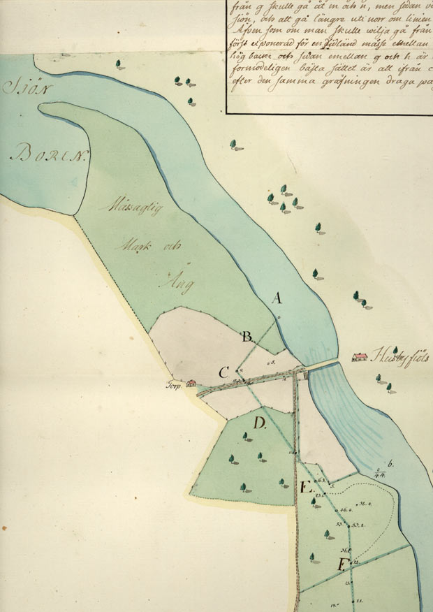
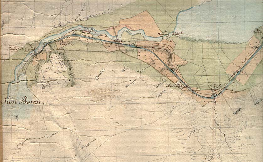
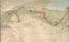
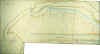
On this map of Husbyfj—l (Borensberg) from 1774, one can see the bridge on the river Motala Str—m and the nearby taverns. The roads and the use of land are also clearly marked on the map.
The words "MÍssagtig (marshy) Land and Meadow" are written on the point by the outlet of Lake Boren. (VaLa) |
|
|
|
|
 |
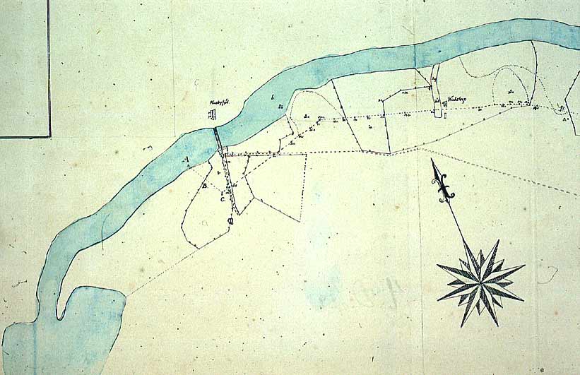
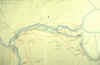
This is probably a draft from the 1770s, in which the cartographer has started to draw buildings, roads, bridges and types of land. |
|
|
|
|
 |
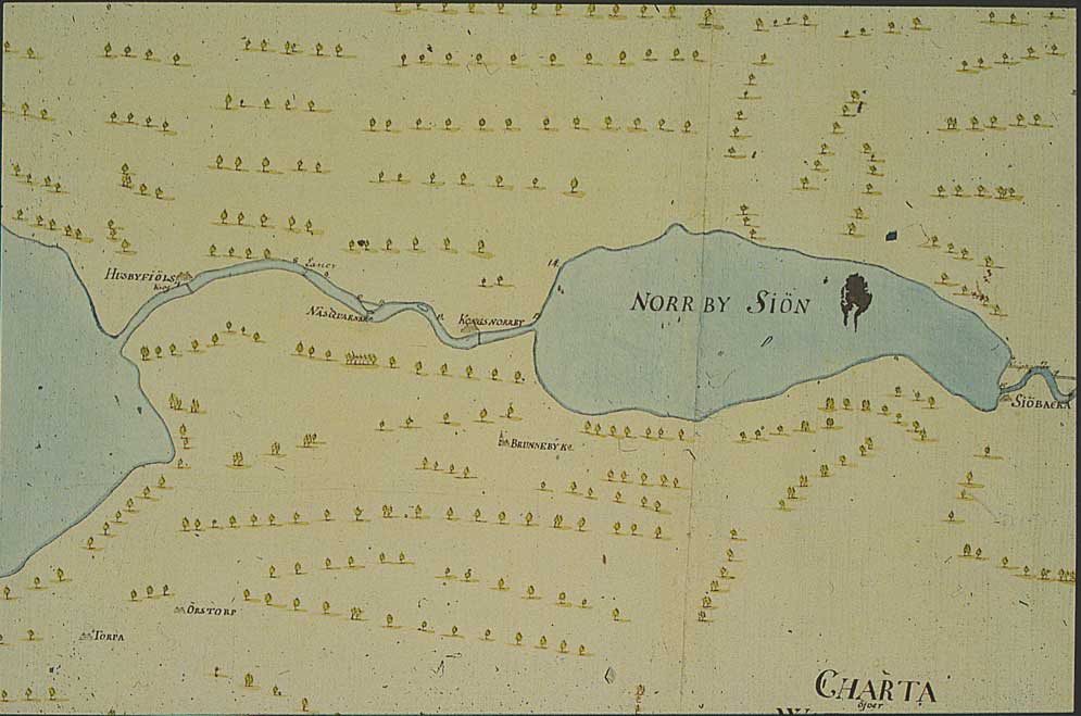
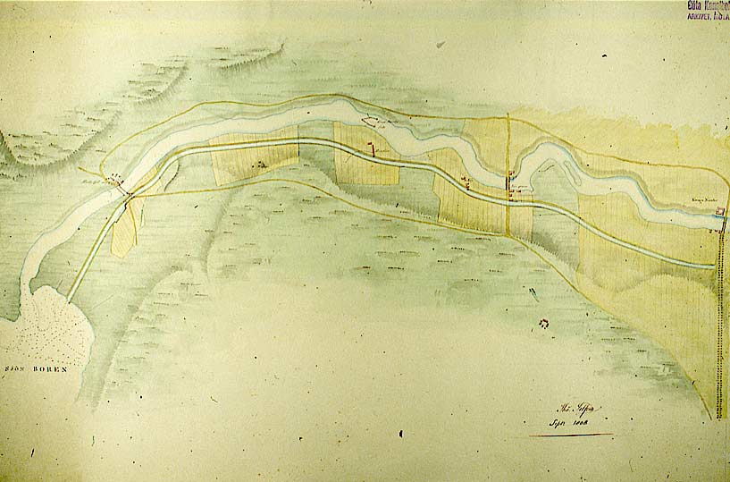
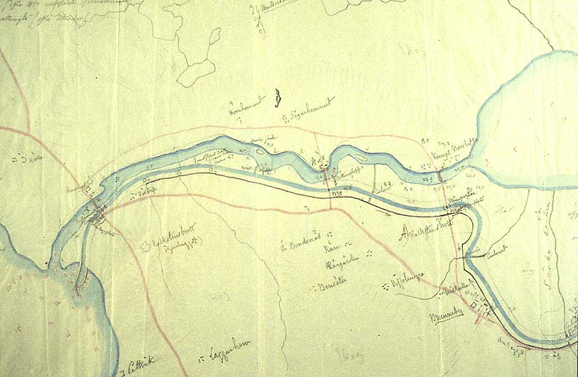
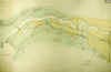
General map from 1784 that shows the actual stretches of canal of that time near the outlet of Lake Boren.
One can also see how the G—ta Canal has received a new, alternative stretch through Kungs Norrby. |
|
|
|
|
 |
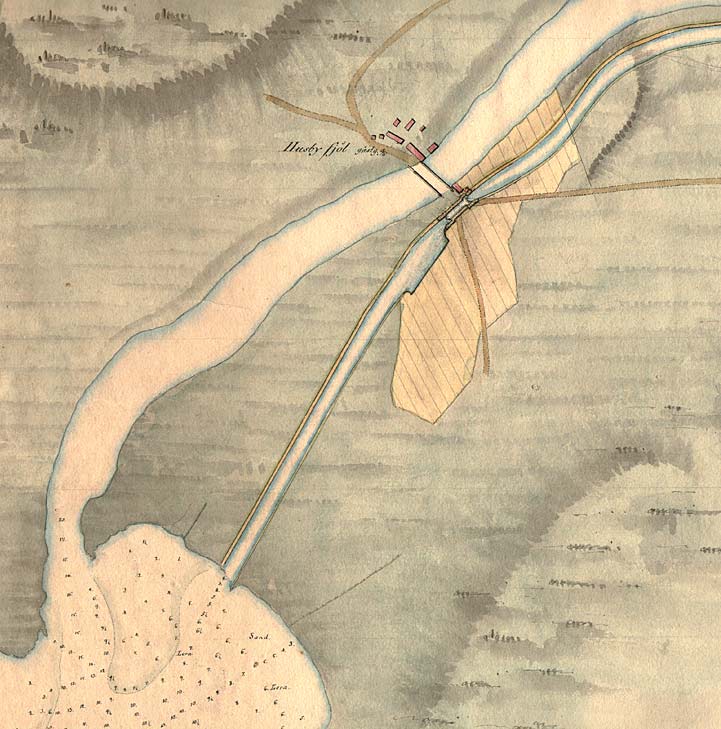
Stretch of canal according to the proposal of 1808. The G—ta Canal runs parallel with the Motala Str—m. A dock has been drawn near the southern abutment beside the main road. Depth measurements near the inlet into Lake Boren are also shown. |
|
|
|
|
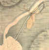 |
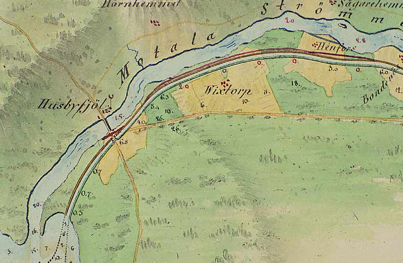
Detailed portion of above map. (Difference in colour is due to that it is a different picture.) Here, one can observe how the buildings near that northern abutment have developed. The tavern now has neighbours. The present-day G—ta Tourist Hotel was built in 1808.
A so-called equalising lock, which compensates for the changes in water level in Lake Boren, has been drawn on the map.
Besides the depth measurements in Lake Boren, another interesting detail on the map is the desciption of the characteristics of the lake bottom.
|
|
|
|
|
 |
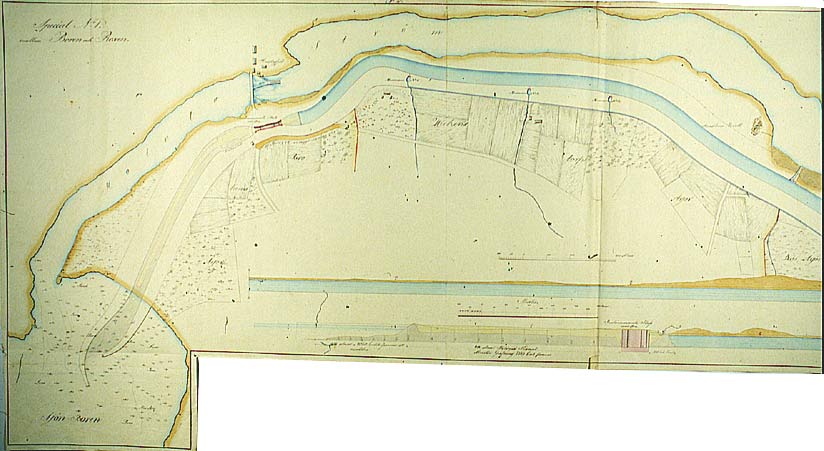
On this unusually beautifully drawn map of Husbyfj—l and Henfors, probably from 1808, one can note the minor revisions that have been made in red pencil. These were more than likely revisions of the canal watercourse, made by the Scotsman Thomas Telford, on his tour of inspection in 1808. |
|
|
|
|
 |
This is a large-scale map from 1823 that indicates how far the building of the G—ta Canal has progressed. One can see that the canal is filled with water all the way up to a holding dike right before the lock at Borensberg. Foundation work on the lock and the harbour, as well as on the connection to Lake Boren, was presumably underway at this time.
Of particular interest on this map are the culverts for crossing streams.
A lengthwise profile has been inserted at the very bottom of the map. |
|
|
|
|
 |
Draft from the 1830s that shows the nearly completed stretch of the G—ta Canal and connecting store houses and docks. (KrA). |
|
|
|
|
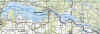 |
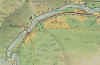
General map of the stretch of canal between Cape Birgitta and SkarpÍsen.
(AB G—ta kanal Tourist Map: Eastern Section, 1995).
Blue line = Gothenburg - Stockholm route of the G—ta Canal used by the firm of shipowners Rederi AB G—ta kanal.
Red line = bicycle path. |