|
Nðs Bridge < Westwards | Cape Birgitta | Borensberg (Husbyfj—l) | Nðs Bridge Kungs Norrby Bridge | S—rby Bridge | Ruda Bridge | Sj—backa Bridge Ljung Bridges | SkarpÍsen | Eastwards > |
The electric power station was driven by six turbines. In 1988, it was replaced by a new power station with two turbines. The power station, along with von Fersen's mill, has today been made into a museum.
(Further reading: Castensson, R., Hillmo, T. & KolsgÍrd, S., Kraften ur Motala str—m (Power from the River Motala Str—m), 1993; WingÍrdh, G., Nðs kvarnby vid Motala str—m (The Mill Village of Nðs on the River Motala Str—m), 1999)
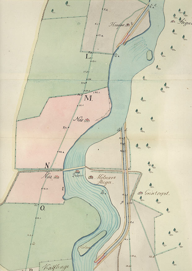
Section of the canal map of a planned stretch of canal around the rapids at Nðs Mill, 1774. Observe that the map is oriented so that North is to the right on the map. The direction of the current in the river Motala Str—m is consequently from the top to the bottom of the map. On the map, one can see how von R——k thought the G—ta Canal would be drawn around the rapids at Nðs and Henfors.
The map shows clearly the various sorts of land usage, e.g. arable fields, meadows and forest. Click on the maps to enlargen!
Use the "Back" button to return. |