kartabor.gif (16759 bytes)


Kungs Norrby Bridge
< Westwards | Cape Birgitta | Borensberg (Husbyfjöl) | Näs Bridge
Kungs Norrby Bridge | Sörby Bridge | Ruda BridgeSjöbacka Bridge
Ljung BridgesSkarpåsen | Eastwards >

vala023159_kungsnorrby_hori_250.jpg (20389 bytes)Detail of the canal map of Kungs Norrby Manor (1774). Note: the map is specifically oriented so that North is to the left on the map.

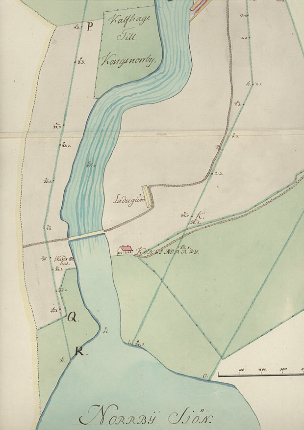
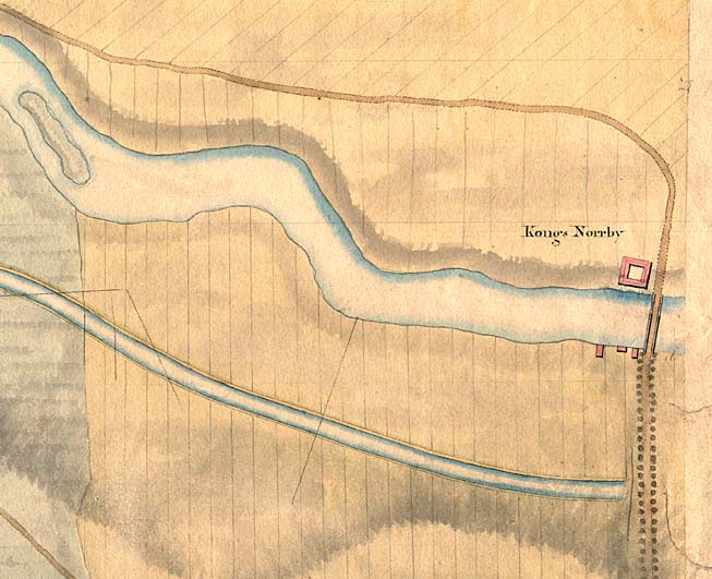
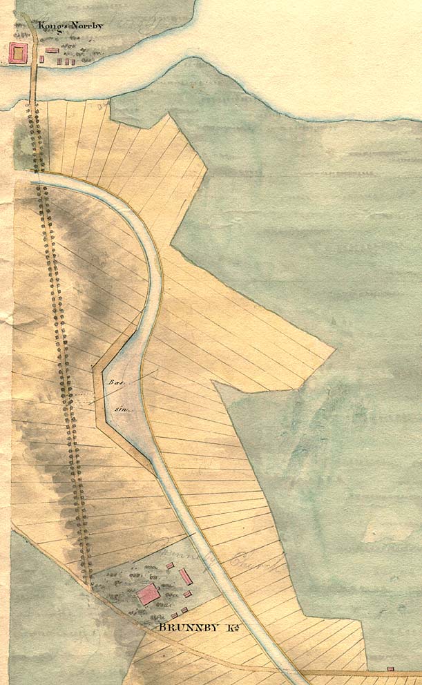
The Manor dates from the time of King Gustav I Vasa in the 16th century. It is located at the river Motala Ström's inlet into Lake Norrbysjön and near the bridge over the river. On the northern bank of the river was an inn, and on the southern bank was the manor, along with a barn. A special road leading away from the main building followed the edge of the field southwards, while the barn was situated along the main road. An enclosed calf pasture was located on the northern bank of the river and the lake (VaLa).

Click on the maps to enlargen!
Use the "Back" button to return.


Other maps of the area:
telf_III12_1808_kungsnorrby.jpg (60251 bytes) On this canal map from 1808, Kungs Norrby is situated at the edge of the map. One can see the section of the main road that crosses over the Göta Canal and the river Motala Ström.
telf_III13_1808_knorrby-bru.jpg (107257 bytes) This canal map is also from 1808. It shows the stretch of canal by Kungs Norrby and the neighbouring Brunneby Manor and Brunneby Church. Compared with the canal map from 1774, the buildings in Kungs Norrby have been moved to the northern bank and the road has taken on a new stretch.

When Baltzar von Platen came to Brunneby Manor to negotiate about recompense of land, he was not allowed entrance indoors. The negotiations were, instead, to take place outdoors at the stone table,which is still there today. This unwillingness was due to the fact that the Göta Canal was to cut right through the garden of the manor.

On the map one can see a faint marking in pencil, which reads "Brunneby Church". This was presumably made by Thomas Telford during his tour of inspection in August 1808.

Brunneby Church was built in the 13th century. In 1828 it was discontinued as a congregational church and was purchased by the lord of the manor/farm in order to use it as a storehouse for aquavit. At that time, digging of the Göta Canal was still in progress. A soldier earned 14 jomfrur of aquavit (1 jomfrur = 8.18 cl) per week for his digging work. When the canal was completed, Brunneby Church was used as a grain storehouse for the manor. It was not until 1977 that the church was purchased by the Royal Academy of Letters, History and Antiquities and returned to its original purpose.

turist_birgittasudde-skarpasen.jpg (200218 bytes) General map of the stretch of canal between Cape Birgitta and Skarpåsen.

(AB Göta kanal Tourist Map: Eastern Section, 1995).

Blue line = Gothenburg - Stockholm route of the Göta Canal used by the firm of shipowners Rederi AB Göta kanal.

Red line = bicycle path.