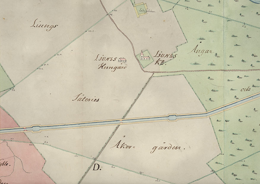
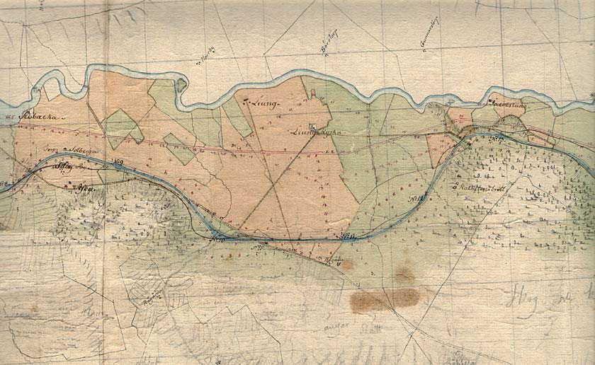
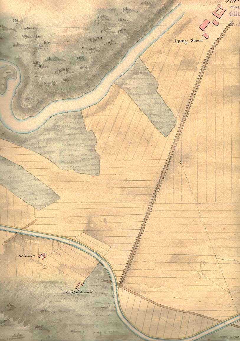
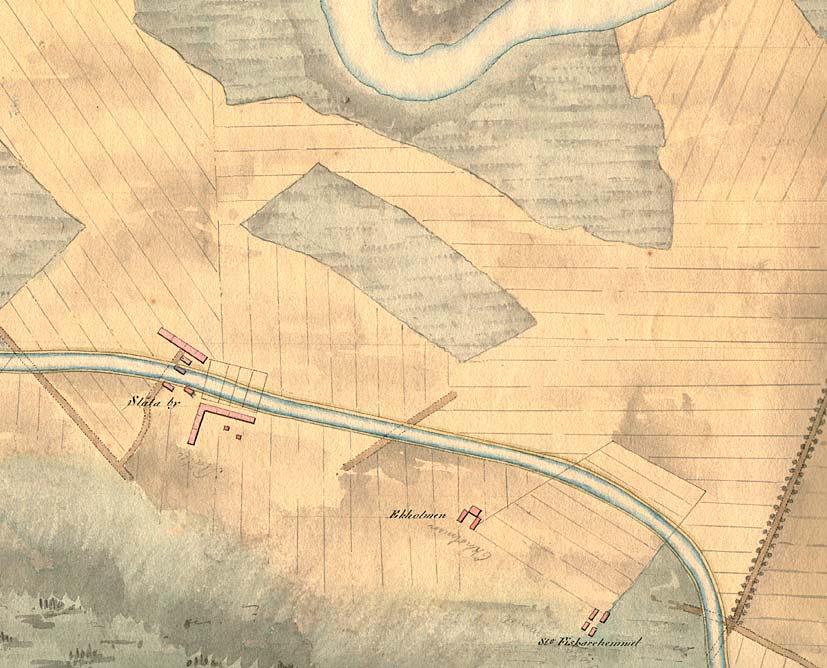
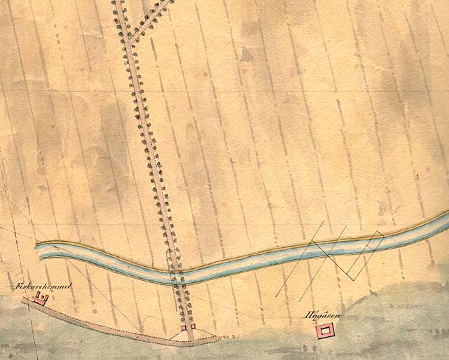
 Ljung Manor has a long history. During the time period in which the canal was built, Ljung Manor was owned by the famous Axel von Fersen. After his unfortunate death in Stockholm, on 6 June 1810, Axel's brother, Fabian, took over the manor. Since the planned stretch of canal was to requisition a large acreage of Ljung Manor, negotiations with Baltzar von Platen regarding recompense of land, bridge connections etc. were rendered long and difficult. The questions of bridge connections to the manor and the mills along the river Motala Str÷m were especially sensitive. As shown on the maps (below), the canal project came to affect three approach roads - one to Ljung Manor and two to Ljung Church. Two of these were eventually given bridge connections. Ljung Manor has a long history. During the time period in which the canal was built, Ljung Manor was owned by the famous Axel von Fersen. After his unfortunate death in Stockholm, on 6 June 1810, Axel's brother, Fabian, took over the manor. Since the planned stretch of canal was to requisition a large acreage of Ljung Manor, negotiations with Baltzar von Platen regarding recompense of land, bridge connections etc. were rendered long and difficult. The questions of bridge connections to the manor and the mills along the river Motala Str÷m were especially sensitive. As shown on the maps (below), the canal project came to affect three approach roads - one to Ljung Manor and two to Ljung Church. Two of these were eventually given bridge connections.
(Further reading: Canal Research at Link÷ping University - Gunhild Wingňrdh, Land losses and Recompensations. In Sw.: Markf÷rluster och markersńttningar, Link÷ping 1993.
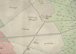
Von R÷÷k's map of Ljung Manor, 1774. Besides the manor and its barn, Ljung Church is also marked on the map (VaLa).
Click on the maps to enlargen!
Use the "Back" button to return.
|