|
Ruda Bridge < Westwards | Cape Birgitta | Borensberg (Husbyfj—l) | Nðs Bridge Kungs Norrby Bridge | S—rby Bridge | Ruda Bridge | Sj—backa Bridge Ljung Bridges | SkarpÍsen | Eastwards > |
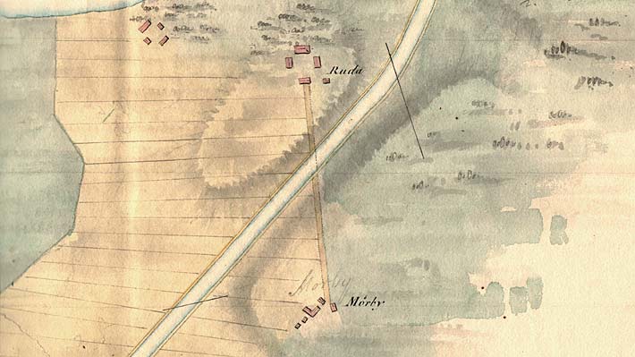
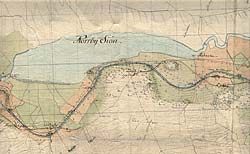
Thunberg's proposal for the stretch of canal by Lake Norrbysj—n, 1784. Click on the maps to enlargen!
Use the "Back" button to return. |
 Ruda Bridge, located on the G—ta Canal, joins the medieval manor of Ruda with the main road from Link—ping to Motala. The manor is located south of Lake Norrbysj—n and has a spectacular outlook from its highest point.